There used to be a job description that came with sitting in the front passenger seat of a car on a long road trip. It wasn't written down anywhere, but everyone understood the terms. You held the map. You tracked the miles. You watched for the exit signs before the driver could see them. You were, in the most practical sense of the word, essential.
Today that seat is occupied by someone watching a Netflix download or half-asleep with AirPods in, while a voice from the dashboard handles everything the co-pilot used to do. The car knows where it's going. The passenger doesn't need to.
It seems like a minor shift. It wasn't.
The Map Was a Shared Responsibility
Anyone who took a long road trip before the mid-2000s remembers the map ritual. Before leaving, someone — usually the designated navigator — would spread the thing out across the kitchen table and trace the route with a finger, maybe a highlighter if they were serious about it. They'd note the major interchanges, write down the highway numbers on a notepad, and fold the map back into something resembling its original shape, which never quite worked.
In the car, the map lived in the passenger's lap or on the dashboard. It was a living document. When the driver said "what's the next turn?" the navigator was already looking. When they passed through a state line, someone would dig the next state's map out of the glove box. Gas stations sold maps. Rest stops gave them away free. A road trip required geographic literacy in the same way that cooking requires knowing where the kitchen is.
The navigator wasn't just reading. They were interpreting. A map doesn't tell you that the exit comes up faster than you expect, or that the junction is poorly signed, or that the highway number changes after you cross the county line. The navigator learned those things in real time and communicated them to the driver with enough notice to actually be useful. That required attention, spatial reasoning, and genuine engagement with the journey.
The Glove Box Was a Mobile Operations Center
Beyond the map, the passenger managed a small but important collection of road-trip infrastructure. The glove box held the vehicle registration and insurance card, obviously, but also: a AAA TripTik if the family was organized enough to get one, hand-written directions from a relative who knew the back roads, a mileage log for tracking fuel economy, maybe a printed list of rest stops along the route.
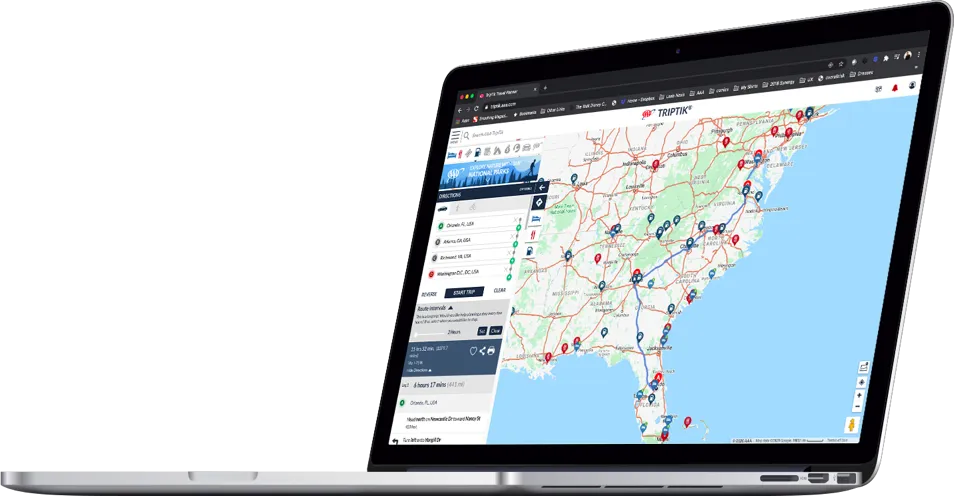 Photo: AAA TripTik, via triptik.aaa.com
Trip planning before GPS was a genuine exercise in preparation. AAA's TripTik was a spiral-bound booklet of map strips, custom-printed for your specific route, with notes about construction zones and seasonal closures. Getting one required going to an actual AAA office and talking to an actual person who would assemble it for you. Families treated these things like sacred documents.
The passenger was responsible for all of it. They cross-referenced the TripTik against road signs. They tracked how many miles had passed since the last fuel stop. They knew — roughly, approximately, based on the map scale and a lot of estimation — how far it was to the next town with a motel. That knowledge shaped decisions. The driver drove. The navigator thought.
What Happened When You Got It Wrong
Here's the thing about navigating with a paper map: you could get it wrong. And when you did, the consequences were real and immediate. You'd miss an exit and find yourself twenty miles down a road that wasn't on the intended route, in a part of the state that looked nothing like where you were supposed to be. Someone would have to figure out how to get back on track using the existing map, the position of the sun, and whatever road signs were visible.
This was frustrating. It was also, in retrospect, kind of remarkable. Two people in a car, working together to solve a spatial problem with limited information and no outside help. The arguments were real. So was the satisfaction when you figured it out.
There was a shared investment in the outcome. Both people in the front seat had skin in the game. The driver couldn't just defer to the dashboard. The passenger couldn't just tune out. The road trip was a collaborative project, and both parties knew it.
The Quiet Handoff to the Machine
GPS navigation arrived gradually. Early in-dash systems appeared in luxury cars in the late 1990s. Standalone Garmin and TomTom units became popular through the mid-2000s. Then smartphones with Google Maps and Apple Maps made the whole thing essentially universal, free, and impossible to ignore.
The handoff was so smooth that most people didn't notice what they were giving up. The navigation moved from the passenger's lap to the windshield mount. The voice took over the job of calling out exits. The map — that big, unwieldy, endlessly useful paper map — moved from the glove box to the recycling bin and eventually stopped being printed at gas stations at all.
The passenger seat, freed from its responsibilities, became a leisure space. A place to scroll, to sleep, to watch something on a phone, to exist in comfortable irrelevance while the route handled itself. Nobody asked the passenger to track anything. Nobody needed them to.
Something Specific Was Lost
This isn't an argument for going back to paper maps. GPS navigation is genuinely better at the core task of getting from one place to another without getting lost. The technology is a real improvement.
But the co-pilot role wasn't just about navigation. It was about shared attention. Two people experiencing the same road at the same time, both engaged with where they were and where they were going. The map gave the passenger a reason to look out the window — to match what they saw against what the map showed, to notice when the terrain changed, to track the journey as it happened rather than waiting for the destination to arrive.
Today's passenger often doesn't know what state they're in until someone mentions it. They couldn't tell you the last highway number they crossed. The journey, for them, is largely happening somewhere else while they look at a screen.
The driver, meanwhile, follows instructions from a voice that never needs a break and never gets the exit wrong. It's efficient. It's reliable. It's also a completely solitary experience happening inside a car with another person.
Then and Now
In 1978, driving from Chicago to St. Louis with your partner meant both of you knew the route. You'd talked through it. You'd divided the responsibilities. When you arrived, you'd both made the trip.
 Photo: St. Louis, via explorestlouis.com
In 2025, the app made the trip. You were just along for the ride.
The passenger seat is still there. It's just not doing anything anymore.